


Aero Acres
Identifier
Surface Type
Runway L × W
Elevation
Fuel
From City
FD88
CONC
3150 ft. x 50 ft.
25
NONE
12 miles SW of FORT PIERCE, FL
⌂ Residential airpark | Not all hangars or buildings allow residential use. Verify the property.

Your Aero Acres Aviation Real Estate Team
Phone or text · Click card to enlarge
Rob: 813-966-4003
Private-airpark tours by prior arrangement.
Talk about airpark community life.
Compare your home, hangar and access priorities.
Current Listings
Market Report
Getting Around from Aero Acres

Airport Distances (straight line, FAA coordinates)
Treasure Coast International (FPR): 14.1 mi / 12.3 NM
Vero Beach Regional (VRB): 22.6 mi / 19.6 NM
President Donald J Trump International (DJT): 52.5 mi / 45.7 NM
Orlando International (MCO): 89.2 mi / 77.5 NM
Fort Lauderdale/Hollywood International (FLL): 90.7 mi / 78.8 NM
Nearby Fuel (FAA, nearest public-use airports)
Treasure Coast International (FPR): 12.3 NM, 100LL and Jet A, attended daily 0700-2100
Okeechobee County (OBE): 18.1 NM, 100LL, Jet A and A+, attended daily 0800-1700
Witham Field (SUA): 18.7 NM, 100LL and Jet A, attended daily 0600-2200
Confirm fuel availability and hours with the airport before flight. FAA NASR data effective 10/29/2026.
Weather & Flying Conditions
Explore the Aero Acres forecast, forecast winds, radar and official pilot-weather resources. Load the latest outlook below; check each source’s location and issue time.
Local Forecast uses airpark coordinates, not an on-site observation. Nearby Pilot Weather opens the AWC map; select a reporting station. Radar opens the NWS map. Climate History opens NOAA records; choose a station and date range. Reference only, not a pilot weather briefing.
Nearby Flying Info
Review the FAA Operations, Communication, Weather and Runway tabs below. Confirm current fuel availability, airport access, NOTAMs and weather before departure. This page is a real estate reference, not a flight briefing or permission to land.
Aeronautical Information Services
FD88
Data Effective:
0901Z 10/29/26 to 0901Z 11/26/26
Aero Acres
Fort Pierce
FL
LAT / LONG
ELEVATION (FT)
VARIATION
FROM CITY
ARTCC
SECTION CHART
TIME ZONE
27-20-31.153 N / 80-31-19.196 W
25
3 W 1985
12 miles SW of FORT PIERCE, FL
ZMA
Miami
America/New_York
Loading FAA airport data...
Please wait while the connected data loads.
Aero Acres (FD88) at a Glance
FAA airport record, data effective 10/29/26. Privately owned, private use.
Location: St Lucie County, 12 miles southwest of Fort Pierce, Florida. Field elevation 25 ft.
Runway 09/27: 3,150 x 50 ft concrete. Medium-intensity runway lights.
FAA lighting remark: MIRL RWY 09/27 - CTAF.
CTAF/UNICOM: 122.9. FAA remarks (as published): PROVIDED VFR/PVT USE. BIRDS ON RWY. FOR CD CTC PALM BEACH APCH AT 561-275-1430.
Unattended (FAA record).
Airport activated: February 1990.
Buying at Aero Acres: ask our team about residential use, hangar access and association rules for each property. Aero Acres is a private-use airport, so prior permission is required. Always confirm current FAA data, NOTAMs and airport permission before you fly.
FAA Sectional Charts · Aero Acres (FD88)

10/29/26 to 12/24/26 Not for navigation. Source: FAA sectional chart.

10/29/26 to 12/24/26 Not for navigation. Source: FAA sectional chart.

10/29/26 to 12/24/26 Not for navigation. Source: FAA sectional chart.
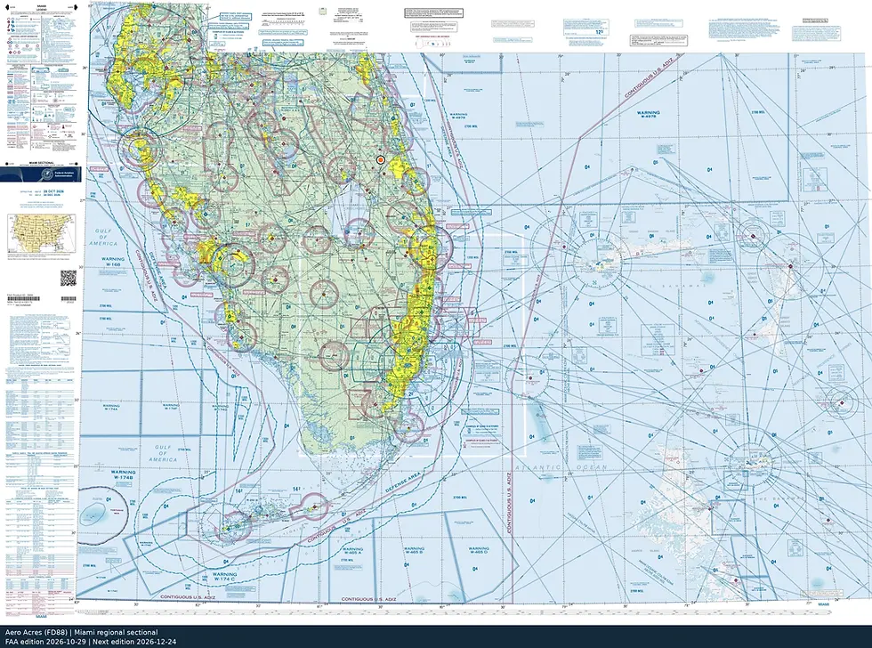
10/29/26 to 12/24/26 Not for navigation. Source: FAA sectional chart.